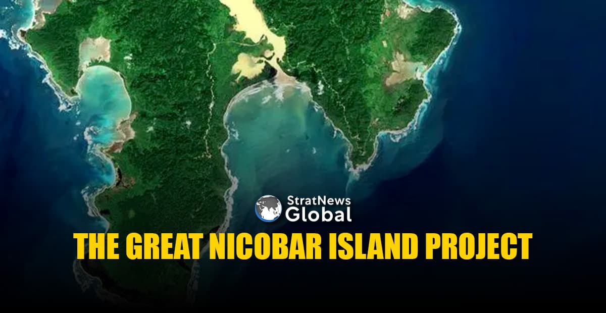
At the intersection of national security, economic ambition and environmental concern sits the Great Nicobar Island Project; a proposal that has, over the past several months, drawn expert opinion from across the fields of strategy, defence, infrastructure, investment and ecology.
These experts are using three aspects interchangeably to support their respective claims:
- Creation of a deep-water port with its associated infrastructure both in the port and hinterland and in particular the International Container Transshipment Terminal (ICTT).
- The strategic and military significance of the location and the infrastructure required for the same, including the planned dual-use airport.
- The environmental impact.
To have a well-informed conversation, it is wise to look at each of these separately before considering the different “combinations”.
The International Container Transshipment Terminal is the ‘centrepiece’ of the Great Nicobar Island project. But what is a transshipment terminal/port?
Why Transshipment Is Needed
When importing or exporting commodities, any country, company or individual should preferably “ship” the goods from its ports to the destination. The ports in that country must have the infrastructure and capacity required for this operation to proceed smoothly. One of the most important factors is the depth of water in the port that large ships can enter to board or supply goods. The lack of depth required for large ships with deep draft to enter and exit is a problem that affects many countries, including some ports in India. As a result, they must use a port that permits entry, loading, unloading and exiting. Ships (mother ships/main lines) arrive at transshipment ports, load, then unload onto smaller ships (feeders) that can then enter the target destination.
The Problem Of Depth
Depth in the port (entry/exit channel and the berths alongside) determines the size of ships that can enter. During my study that contributed towards my thesis, I had compiled data on India’s ports with special reference to the draught. The data was primarily sourced from the Ministry of Shipping annual reports, supplemented by certain other sources. Some of the data is reproduced below.
No.LocationName of PortDraft (m), maxMajor Ports1.Kolkata (Haldia)Syama Prasad Mookerjee Port8.02.ParadipParadip Port14.53.VisakhapatnamVisakhapatnam Port14.5/18.54.ChennaiChennai Port15-16.55.EnnoreKamarajar Port Limited156.TuticorinV.O.Chidambaram Port14.27.KochiCochin Port12.58.New MangaloreNew Mangalore Port14.09.MormugaoMormugao Port1410.MumbaiJNPT1511.MumbaiMumbai Port1212.KandlaDeendayal Port14.1Private Ports13.MundraAdani Mundra Port17.514.HaziraAdani Hazira Port Ltd14.015.DahejAdani Petronet (Dahej) Port Pvt Ltd15.516.KrishnapatnamAdani Krishnapatnam Port Ltd17.517.GangavaramAdani Gangavaram port Ltd19.518.DhamraDhamra Port Company Ltd17.2A cursory glance at tankers and bulk carriers brings out the following in terms of their size and draft, vis-à-vis Indian ports:
- Crude and product oil tankers’ size and draft are determined by their routeing; Suezmax-sized tankers (125,000 to 199,999 T) have a draft of roughly 20 m. These are, therefore, unable to enter any Indian port, the reason India has created many Single Point Moorings (SPM) outside harbours for trade in crude and product.
- Bulk carriers also come in different sizes. At certain ports, anything larger than a Panamax (draft 12.04 m) will encounter difficulties. Certain Indian ports are accessible to the Neopanamax (draft 15 m).
It is evident that depth is a problem in several of India’s ports. For its transshipment needs, India mostly employs Colombo, Singapore, Port Kelang and Dubai. After entering these ports, the mother ships and main liners disembark and re-embark cargo and containers to and from India onto feeders (ships) that can reach their specified target port within the Indian subcontinent. These transshipment services are profitable for the ports that offer them.
Connectors
Depth in the port is not the only criterion for a viable and efficient transshipment port. There are various other ‘connectors’ that keep the port ticking.

A deeper look at this image of the Vizhinjam Deep Water Port, sourced from the port’s webpage, reveals some of the “connectors,” which include vehicles, cranes, ships (feeder boats) and a variety of other services. A quick examination of ships and cranes, two of the primary requirements, could provide more context to our conversation.
Ships
With a fleet capacity of over 37 million dead weight tonnes as of January 1, 2025, or 1.5% of the world’s total fleet capacity, India was placed 17th in the world for ship ownership, according to the United Nations Convention on Trade and Development’s (UNCTAD) 2025 Annual Report. However, 53% of India’s ships are registered under foreign flags. Furthermore, India’s flag registry ranks 20th in the world, with 1,928 ships registered under the Indian flag totalling 18 million dead weight tonnes, or 0.7% of the world’s fleet capacity. India uses both domestic and foreign-flagged ships to meet its needs.
India has created an extremely ambitious plan to increase shipbuilding, ship ownership, and the number of Indian Flag vessels under its Maritime India Vision 2030 and being furthered through the Maritime Amrit Kaal 2047. These and other ships, whether from Indian or foreign ports, currently meet India’s demands and will continue to do so for some time to come. However, the regulations governing foreign-flagged ships cast doubt on their availability in any conflict, jeopardising India’s national security. The Indian government has initiated several marine governance and regulatory reforms to partially address these issues. However, continuing is seen to be essential.
Cranes
Cranes are indispensable at every port. The most important ones are the Ship-to-Shore (STS) for loading and unloading containers from vessels at quayside, the Rubber Tyred Gantry (RTG) for stacking containers in the yard, and the Rail Mounted Gantry (RMG) for stacking containers on tracks. Shanghai Zhenhua Heavy Industries Co. (ZPMC), a Chinese state-owned company and the world’s largest port crane builder, controls 75–80% of all STS cranes erected globally. Additionally, ZPMC STS cranes are in operation at Nhava Sheva and Vizhinjam in India. It is important to note that India purchased Mobile Harbour Cranes (MHC) from Italy for the Chabahar Port project. The drawback of MHC vis-à-vis STS, in a single word, throughput.
Access To Int’l Shipping Lanes
Along with depth, ships, and infrastructure for a quick turnaround, access to international shipping channels is one of the most important requirements because mother/main liner ships convey cargo to multiple locations. They use as few departures from the recognised International Shipping Lanes (ISLs) as feasible.
The Great Nicobar Island project needs to be viewed in this light. The “deviations from the mean” are highlighted by a quick look at the perpendicular distance between some significant ports in the Indian Ocean Region (IOR) and the most important artery, the ISL, which starts in the Strait of Hormuz, travels the length of the Arabian Sea, skirts Sri Lanka and enters the Malacca Strait. After Singapore and Port Klang in Malaysia, which are essentially at the top of the ISL, the Great Nicobar Island project has the least variation.
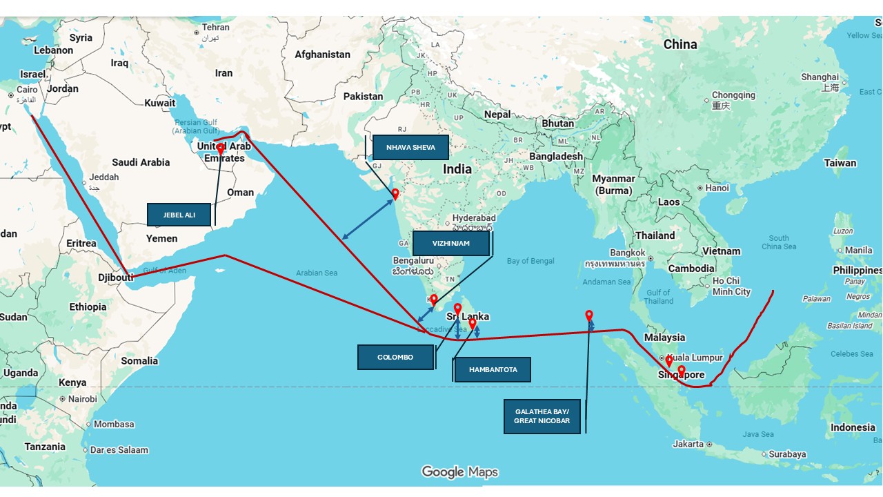
The interesting thing about this picture is that, compared to Hambantota, Colombo is farther from the ISL. Despite Hambantota’s deep-water advantages, Colombo continues to dominate regional transshipment owing to higher throughput, infrastructure maturity, shipping-line confidence and established logistics ecosystems.
Advantage Galathea
Therefore, when we look at deep-water port with its associated infrastructure both in the port and hinterland, and particularly the International Container Transshipment Terminal (ICTT) at Galathea Bay, the following clearly stand out.
- The distance from the ISL is the biggest advantage.
- The port can emerge as a regional transshipment alternative for selected trade flows currently routed through Singapore, Port Klang and Dubai in the medium to long term. The alternative to Colombo is Vizhinjam (both of which interestingly are operated by Adani Ports), which when all phases are complete and connectivity improves will save India foreign currency and enhance logistic efficiencies.
- Ships disembarking/embarking for India at Dubai/ Singapore/Klang can do so at Galathea Bay too, particularly for India’s east coast ports, as also Bangladesh, Myanmar, Thailand and the northern island regions of Indonesia.
- Ships will continue to be what are operated today, more foreign flagged than Indian; currently a national vulnerability. However, with increasing focus on streamlined regulatory practices and maritime reforms, international shipping lines are reflagging/ exploring plans to reflag vessels to Indian Registry.
- The port will take a considerable time to ensure its infrastructure and operational management are effective. This facet has been factored into the project as it has been assessed that the port is unlikely to generate revenue till the 17th year of operation.
Galathea Bay clearly has an advantage. However, is it only geographical or are there other factors too that be qualified by ‘how much’, a crucial indicator that should provide some numerical assessment? The below table tries to look at this issue in brief.
MetricColomboVizhinjamGreat NicobarDistance from ISL (perpendicular distance) in nautical miles10019022Current Twenty-foot Equivalent Unit (TEU) container throughput8.2 million TEU2 million6 million (planned in phase I)Expansion potential19 million (2030)5.7 million21 millionDraft (maximum)14-18 m18-20 m≥ 20 m(This is the first of a two-part series. The author holds a Ph.D. from the University of Mumbai and four master’s degrees. His areas of interest include geopolitics, geo-strategy, geo-economics, and their influence on national security and economic development, with India’s growth and security at its core. Views expressed here are personal.)